


Voting District 040002, Cayuga County, New York
About
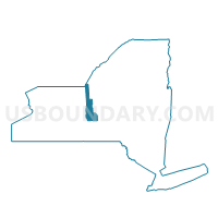
Outline

Summary
| Unique Area Identifier | 625738 |
| Name | Voting District 040002 |
| County | Cayuga County |
| State | New York |
| Area (square miles) | 23.61 |
| Land Area (square miles) | 21.79 |
| Water Area (square miles) | 1.82 |
| % of Land Area | 92.30 |
| % of Water Area | 7.70 |
| Latitude of the Internal Point | 43.11589060 |
| Longtitude of the Internal Point | -76.54573470 |
Maps


Graphs
Select a template below for downloading or customizing gragh for Voting District 040002, Cayuga County, New York


Neighbors
Neighoring Voting District (by Name) Neighboring Voting District on the Map
- Voting District 030001, Cayuga County, NY
- Voting District 030003, Cayuga County, NY
- Voting District 040001, Cayuga County, NY
- Voting District 050002, Cayuga County, NY
- Voting District 050003, Onondaga County, NY
- Voting District 090002, Onondaga County, NY
Top 10 Neighboring County Subdivision (by Population) Neighboring County Subdivision on the Map
- Lysander town, Onondaga County, NY (21,759)
- Elbridge town, Onondaga County, NY (5,922)
- Brutus town, Cayuga County, NY (4,464)
- Cato town, Cayuga County, NY (2,537)
- Conquest town, Cayuga County, NY (1,819)
Top 10 Neighboring Unified School District (by Population) Neighboring Unified School District on the Map
- Jordan-Elbridge Central School District, NY (9,065)
- Port Byron Central School District, NY (6,397)
- Cato-Meridian Central School District, NY (5,818)
- Weedsport Central School District, NY (5,375)
Top 10 Neighboring State Legislative District Lower Chamber (by Population) Neighboring State Legislative District Lower Chamber on the Map
Top 10 Neighboring State Legislative District Upper Chamber (by Population) Neighboring State Legislative District Upper Chamber on the Map
- State Senate District 54, NY (302,881)
- State Senate District 49, NY (296,854)
- State Senate District 50, NY (296,761)
Top 10 Neighboring 111th Congressional District (by Population) Neighboring 111th Congressional District on the Map
Top 10 Neighboring Census Tract (by Population) Neighboring Census Tract on the Map
- Census Tract 120, Onondaga County, NY (5,922)
- Census Tract 402, Cayuga County, NY (4,743)
- Census Tract 404, Cayuga County, NY (4,464)
- Census Tract 114.02, Onondaga County, NY (4,254)
- Census Tract 403, Cayuga County, NY (4,197)